HOME / Posts Tagged: maps
How to get rid of Google Maps, create your custom maps at Mapbox
MapBox is making it easy to setup a map that will not have the “everyone has it” Google Maps look. Already used by apps and sites like Foursquare and Evernote, Mapbox utilises open sourced map data from OpenStreetMap (www.openstreetmap.org) but also provides terrain and satellite layers. But the big difference from Google Maps is that [Continue reading]

No-Flash Maps with jQuery
// There are tons of Flash-based map solutions and there is always Google maps integration, but what if you want a more visually simplified, tablet-ready solution that will not depend on external sources? JQVMap is a #jQuery plugin that renders #Vector #Maps. It uses resizable Scalable Vector Graphics (SVG) for modern browsers like Firefox, Safari, [Continue reading]
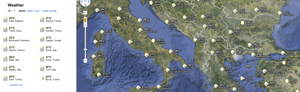
Rain or shine, see the weather in Google Maps
It’s strange but after my recent post on maps I keep finding new advances on the issue. Google today announced a weather layer for Google Maps. Whether you’re organizing a trip overseas or a picnic at a local park, knowing the weather forecast is a crucial part of the planning process. Today, we’re adding a [Continue reading]
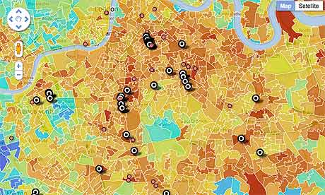
Mapping poverty and riots
What happens when you combine a big amount of data with a map? Do you get a new view in your subject, perhaps even new knowledge, or just a fancy way to promote your ideological stance on the issue? “These riots were not about poverty,” said David Cameron yesterday. ” That insults the millions of [Continue reading]
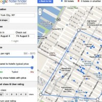
Online maps evolution heats up
After a period where progress seemed to have stopped, web-based map services are heating up again. Here are some recent developments: Google is expanding it’s travel-related services with a new interface to search for hotels and see their location at the same time: Google’s Hotel Finder (not to be confused with HotelFinder.com) can find the [Continue reading]